Paper Map or Offline Map for a Western Day Trip
Choose a paper map or offline map for a Western day trip by matching your route, navigation needs, and backup plan to the tool you can use reliably.
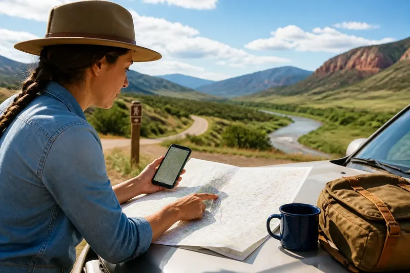
For a Western day trip, choose a paper map or offline map by asking what decision you are most likely to face: where the day fits in the region, or where you are at a particular junction. Carry one map when it clearly answers that question and you have checked it before leaving; carry both when the day needs a regional overview and precise local navigation, or when either source has a gap.
Choose a paper map when you need a regional overview
A folded road map keeps towns, major roads, mountain passes, and river corridors in one view. That broad scale can help you compare possible routes and understand how far apart places are without repeatedly zooming or switching screens.
Paper is also convenient for shared planning. A companion can follow the same map, point to a road, or make a pencil note about a turn to check later. It is less useful when you need to identify a specific access road or distinguish among closely spaced trail junctions.
Check the map’s scale and coverage before treating it as your only navigation aid. If the relevant area appears too small to show the road or trail details you need, choose an offline digital map for those decisions or carry both formats.
Choose an offline map when local position matters
An offline map stores map data on your phone so you can consult it without a live connection. Before leaving service, download the area you plan to visit and open it with mobile data turned off. Confirm that the map itself remains visible; some app features may still require a connection.
A phone map can be easier to consult at a complicated junction, in a spread-out town, or near an access point with several nearby roads. You can zoom in and compare the position marker with the route shown on screen. The map is only as useful as its saved coverage, so check that the download includes both your destination and the roads or trails leading to it.
Consider whether the phone will be usable throughout the outing. A low battery, bright sun, cold hands, or a difficult-to-read screen can make it awkward to consult. Keep it protected and accessible, and stop in a safe place before looking at it near traffic.
Use this decision rule to choose one map or both
Carry one format if the route is familiar or straightforward, that format covers the decisions you expect to make, and you have confirmed it is ready. Add the other format if the day combines broad route choices with close navigation, the primary map omits useful detail, or a device-dependent plan needs a backup. A backup should solve a specific problem, not simply add another item to the bag.
- Check route complexity: If the route has few clear turns, use the format that covers it well; if junctions are close together, add an offline map or a detailed paper map.
- Check the map’s scale and labels: If the paper map shows the needed roads and landmarks clearly, it may be enough; if details are too crowded or small, use a suitable digital map as well.
- Check offline coverage: If the saved area includes the destination and connecting roads or trails, the phone can serve as your local reference; if coverage is uncertain, download the missing area or carry a paper map that covers it.
- Check phone readiness: If the phone opens the saved map and has adequate charge for the outing, it can be your sole map for a simple route; if it does not, use paper or prepare the device before departure.
- Check whether you need a shared overview: If companions need to compare route options together, bring a paper map; if one person is following a clear route, a ready offline map may be sufficient.
- Check the consequences of a map gap: If a missed turn would be easy to correct using signs and nearby roads, one reliable map may be enough; if access is unclear or the route has few alternatives, carry both and confirm conditions with current local guidance.
Say you are planning a drive between two small towns, with a short walk to a river access point and several possible stops. You want to compare the alternatives across the region, but the paper map does not show the access road clearly. You mark the preferred corridor and an alternate on paper, then download the access area and connecting roads to your phone and verify that the saved map opens with mobile data off. The result is a paper reference for choosing the day’s direction and an offline close-up for the final turn; if the phone fails to open, you know to check the access details before setting out rather than relying on a missing map.
Prepare the map before you reach a junction
For paper, identify the route and nearby alternatives, check that the map covers the whole outing, and fold it so the relevant area is easy to find. For a phone, save the map at a useful zoom, confirm the download boundary, and open the saved area with mobile data off.
Compare either map with signs and current conditions. A printed road or digital route may not make access restrictions clear, and conditions can change. Follow posted signs and land manager guidance; if access or route rules remain uncertain, ask the relevant local authority or a qualified local professional.
What should you check before relying on either map?
Does an offline map work without cell service?
Saved map data can remain available without a live connection, but coverage and app features vary. Open the saved area with mobile data turned off before departure; if it is missing or unusable, download it again or carry a suitable paper map.
How much area should you download?
Include the destination and the roads or trails connecting it to your route, along with an alternate area if you expect to use one. Check the app’s download boundary; if a needed section falls outside it, expand the saved area or use another map for that section.
Can a phone replace a paper map?
For a familiar, straightforward outing, a phone may be enough if the saved map covers the route and the device is ready to use. If you need a shared regional view or a backup that does not depend on the phone, bring paper as well.
Which map is better for a trail day?
Check what each map actually shows for the planned route. If a paper topographic map clearly presents the terrain and nearby features, it can be a useful primary reference; if an offline map shows the trail and position clearly, use it for junction checks, and carry both if neither covers the whole need.
The choice between a paper map and an offline map is simplest when you match the format to the decision, then verify its coverage and readiness. If only one map makes sense for your day, carry that one; if your plan needs both regional context and precise location, let each format handle the job it does best.